Map Reading Skills and Volcano Models
02 Feb 2024
Our research into volcanoes and earthquakes has continued this week. We focussed on map reading skills and worked in groups to find the names of the earth’s tectonic plates. Then, we used atlases to locate famous volcanoes. We discovered that the majority of volcanoes occur around the edges of the Pacific Ocean and this string of earthquakes and volcanoes form a horseshoe shape pattern called ‘The Ring of Fire’.
We've been thinking about ways that we can share our knowledge about earthquakes and volcanoes. On Monday, we decided to make models of volcanoes. We also plan to record our knowledge in posters and information texts next week.
First, we planned how we would create our models, then we collected the recycling materials that were needed. We began with a bottle, which will later be used hold the ingredients that will make the ‘eruption’. Some groups added more than one bottle, to represent the secondary vents and fumaroles. Then, we used card to begin to form a mountain structures.
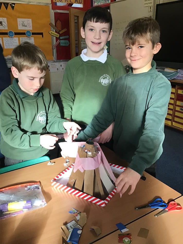
Once the mountain took shape, we attached tissue paper to fill the gaps and then covered the structure with papier mache.
When the models had dried, we painted them.
We’re looking forward to creating eruptions in our volcanoes when the paint is dry, so there will be photographs of that next week!
We really enjoyed the activity and everyone showed really good team skills, sharing ideas and cooperating positively with each other.
For your information
The recent issues with the class email account have now been resolved and we can now be contacted again on class2@gfschools.co.uk.
Happy Weekend!
Miss Wray and Mrs Micklefield